Mammoth Lakes: At the Base of Everything
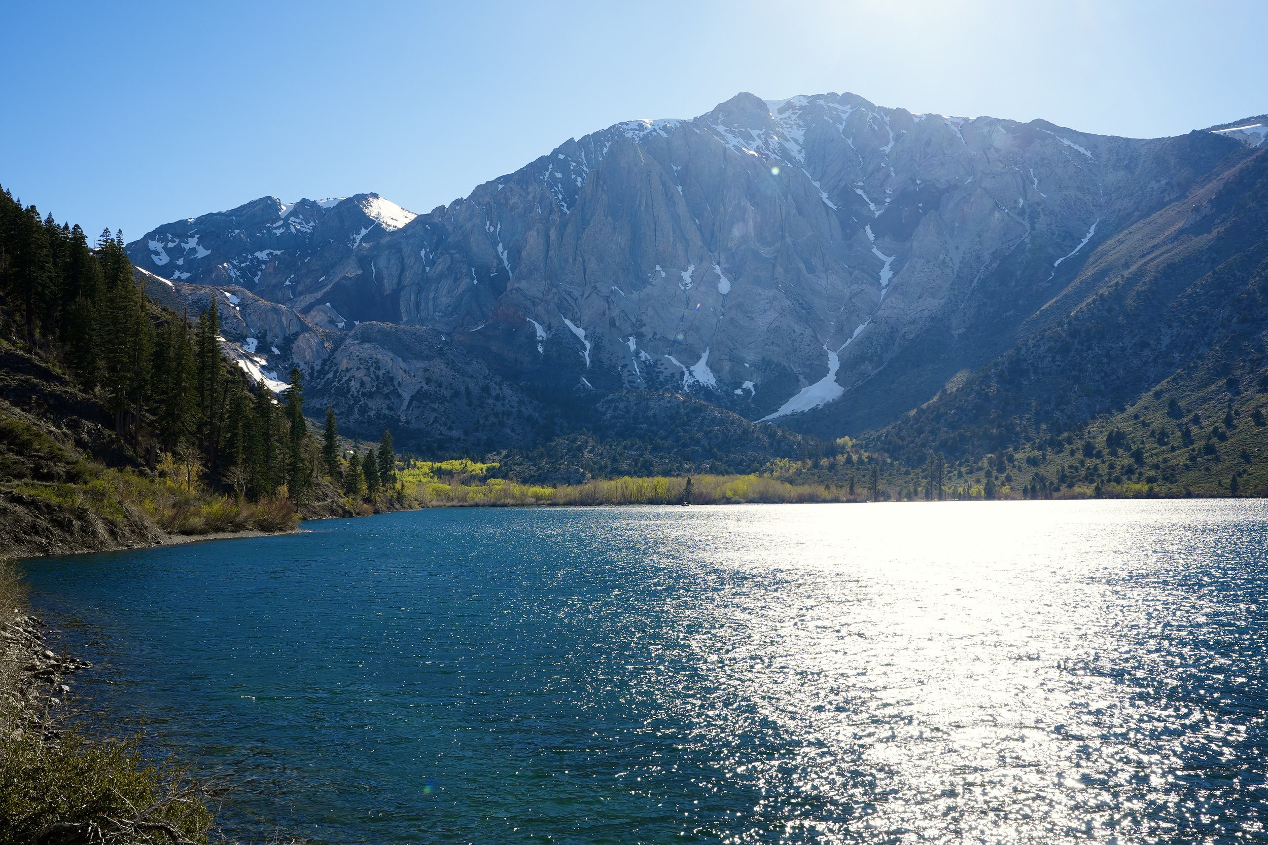
Convict Lake, at the foot of the Eastern Sierra's oldest exposed rock. The metamorphic formations in the surrounding hillsides date back 350 to 400 million years. The water is the color of something that has no name.
The Eastern Sierra arrives all at once.
Coming north on US-395 from the high desert, the mountains appear on the left like a wall someone forgot to explain — white-tipped, granite-flanked, rising from the floor of the Owens Valley so abruptly that the transition from flat to vertical feels less like a landscape and more like a fact. There is no foothills preamble here, no gradual ascent. The Sierra Nevada's eastern escarpment is the most dramatic mountain face in the contiguous United States — a fault-driven wall that drops nearly ten thousand feet from the crest to the valley floor in the space of a few miles. The road runs along the base of it, and for long stretches there is nothing on either side but sage and sky and the receding line of peaks.
The town of Mammoth Lakes sits at 7,880 feet on the volcanic shoulder of this range, inside the Inyo National Forest, at the southwestern rim of one of North America's most geologically significant features. The Long Valley Caldera — 19 miles long, 10 miles wide — was formed 760,000 years ago by a supervolcanic eruption so large it deposited ash as far east as Nebraska. Mammoth Mountain itself, at 11,059 feet, is a lava dome complex that stopped erupting only 57,000 years ago. It still vents carbon dioxide from its south flank at concentrations high enough to have killed more than 170 acres of conifers near Horseshoe Lake. Seismologists measure earthquake swarms here routinely. The mountain, in the most technical sense, remains active.
None of this is apparent from the ski lifts.
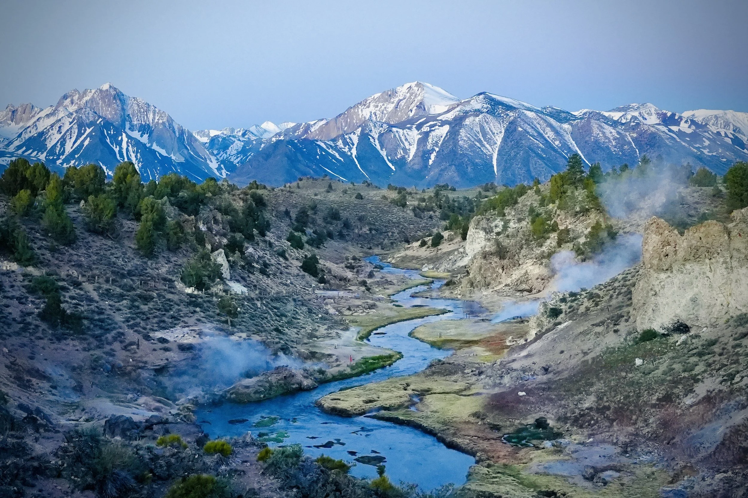
The Hot Creek geothermal area, where the volcanic plumbing of the Long Valley Caldera vents through the valley floor. The river runs through it. The steam is not mist.
The Hot Creek gorge is where the geology becomes impossible to ignore. Standing on the overlook in early morning, the scene below reads as surreal: a blue river winding through a pale, steaming canyon, geothermal vents rising on both sides, the rock stained ochre and rust and sulphur-yellow by mineral deposits, and behind it all a snow-covered peak so large it absorbs the entire upper third of the frame. This is not a dramatic interpretation of the landscape. This is simply what the landscape looks like. The earth here is still in conversation with its own interior, and the river has no choice but to run through the middle of it.
What Mammoth Lakes understands about itself — and what most visitors understand too, even if they don't articulate it — is that the scenery is not incidental. It is structural. The town exists because the mountain exists, and the mountain exists because the caldera exists, and the caldera exists because this entire region is one of the most volcanically active corridors in North America. The snowpack that makes Mammoth Mountain the highest ski resort in California, averaging over 400 inches annually, is a direct product of Pacific storms hitting this barrier wall and dropping everything they have before crossing into Nevada. The meltwater feeds the Owens River, which feeds a system of lakes and reservoirs that supplies a significant portion of Los Angeles' water — delivered through an aqueduct that stretches 233 miles south. The mountains that look like scenery are, in fact, infrastructure.
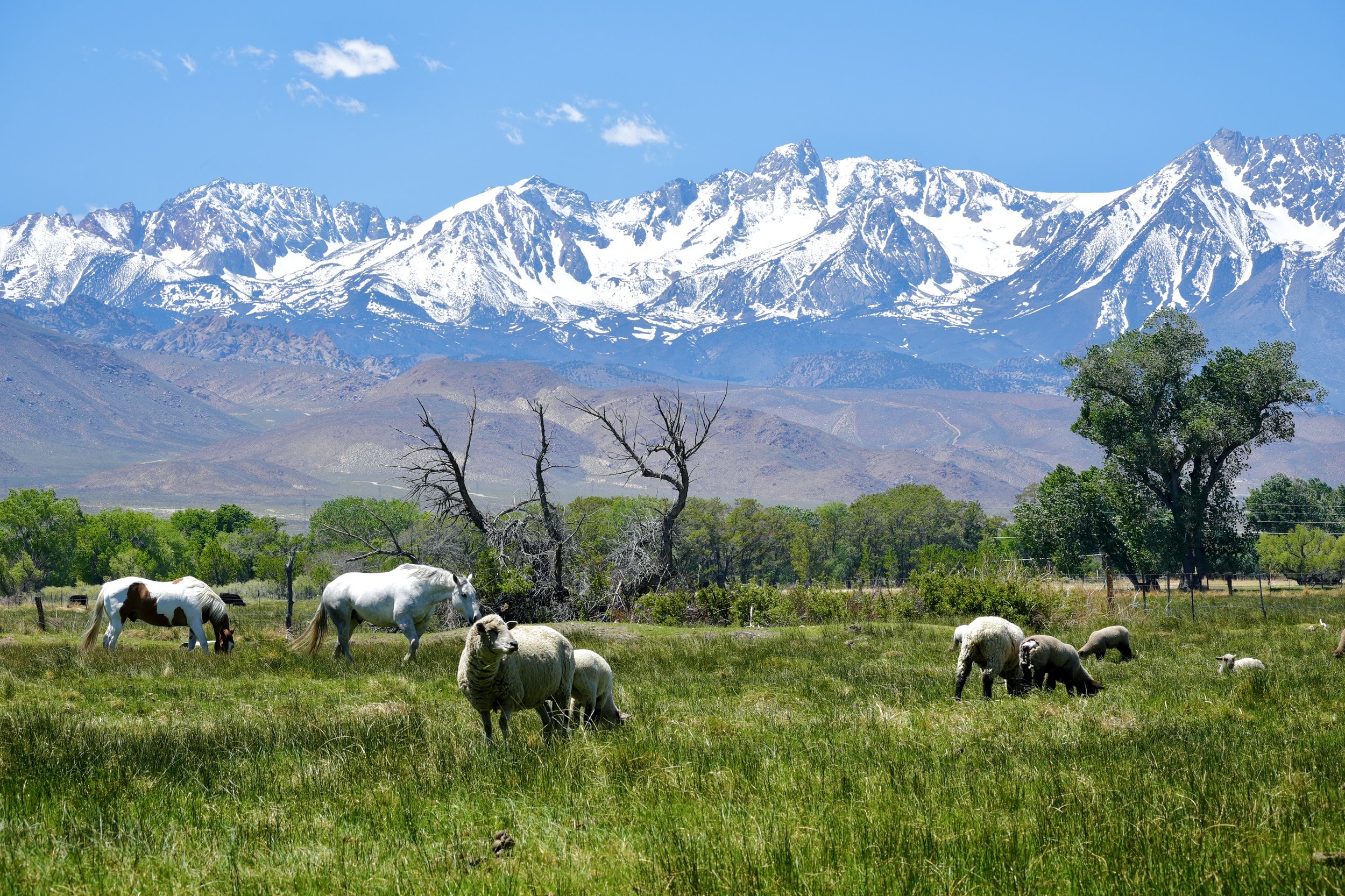
A working ranch in the Owens Valley, with the Sierra crest above. The same snowpack that feeds Los Angeles also waters this pasture. Everything in this frame is connected.
The Owens Valley below the mountains tells a different story from the resort town above it. Down here, at roughly 4,000 feet, the landscape is ranching country — wide, green-floored in spring, dotted with cottonwood and willow, with the mountain wall looming impossibly close to the west and the gentler White Mountains rising on the east. Sheep graze in pastures that exist because of snowmelt. Horses stand in fields watered by the same system that supplies the ski runs eighteen miles up the road. The valley has been farmed since the Paiute people cultivated its meadows long before any European settlement, and the ranching economy that replaced that way of life in the 19th century has proven surprisingly durable — even as the valley's water was gradually diverted south by the Los Angeles Department of Water and Power beginning in 1913, in what remains one of the most contested water appropriations in American history.
The Owens Lake, once 100 square miles of water at the valley's southern end, was reduced to a dry salt flat by the mid-1920s as the aqueduct carried its inflows south. It became the largest single source of particulate air pollution in the United States — a public health crisis that required decades of mitigation. The snow on the mountains visible from these pastures flows toward two destinations: the valley below, which kept some of it, and the city 233 miles south, which took most of it.
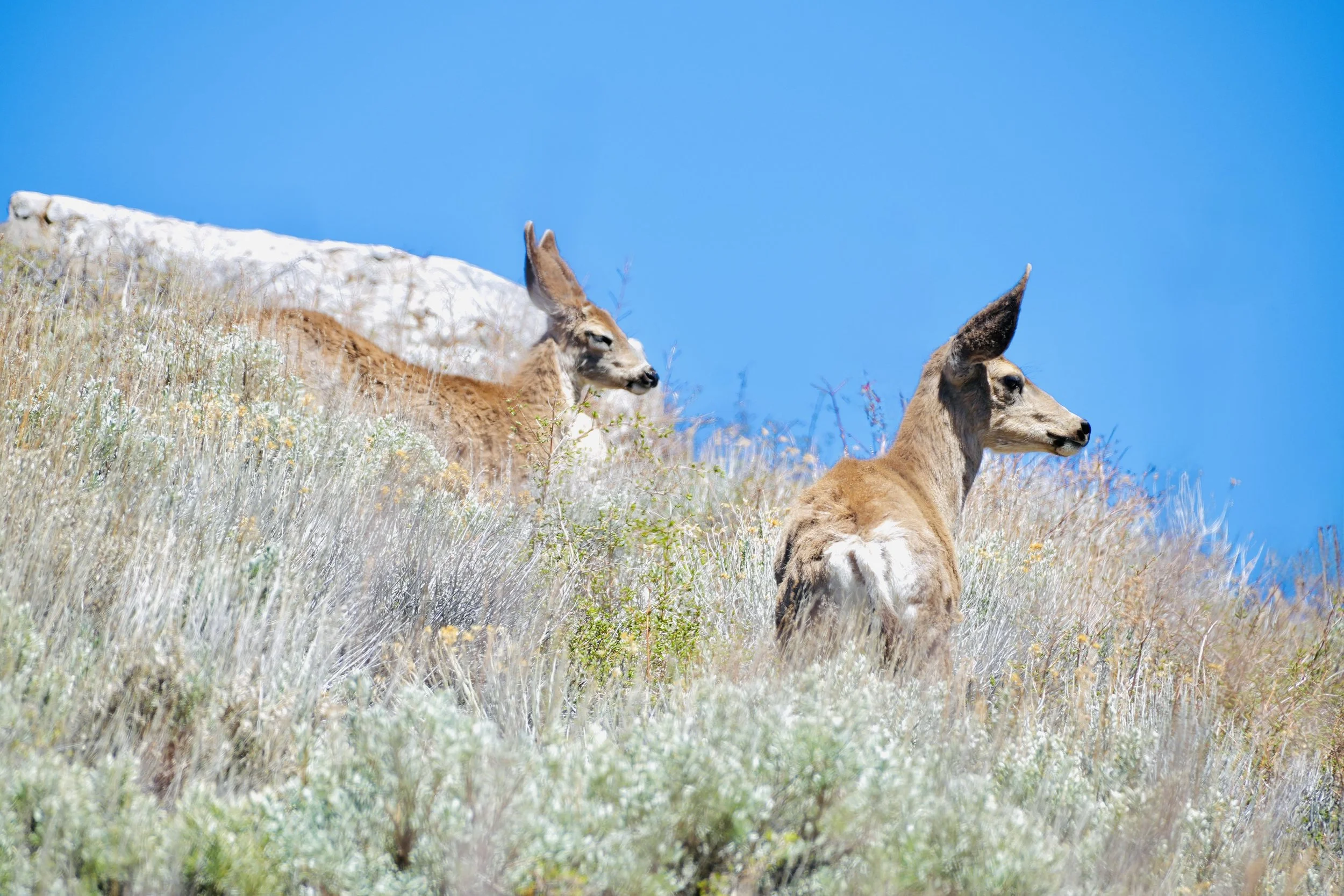
Mule deer in the sage above the valley floor. Mule deer in this region migrate vertically — following the snowline up in spring and back down before winter. The mountains determine the schedule.
The mule deer move through the sagebrush on the valley slopes with the particular unhurriedness of animals that have not yet learned to be afraid of cars. In spring, when the snowmelt is running and the sage is still silver-green and the sky has that high-altitude clarity that makes distances seem both closer and further than they are, the valley is extraordinary — not in the curated way of a national park, but in the way of a place that hasn't been reorganized around the fact that people come to look at it. The deer are here because they have always been here, migrating seasonally between the valley floor and the high elevation meadows, following the same elevation gradient that the snowmelt follows in reverse.
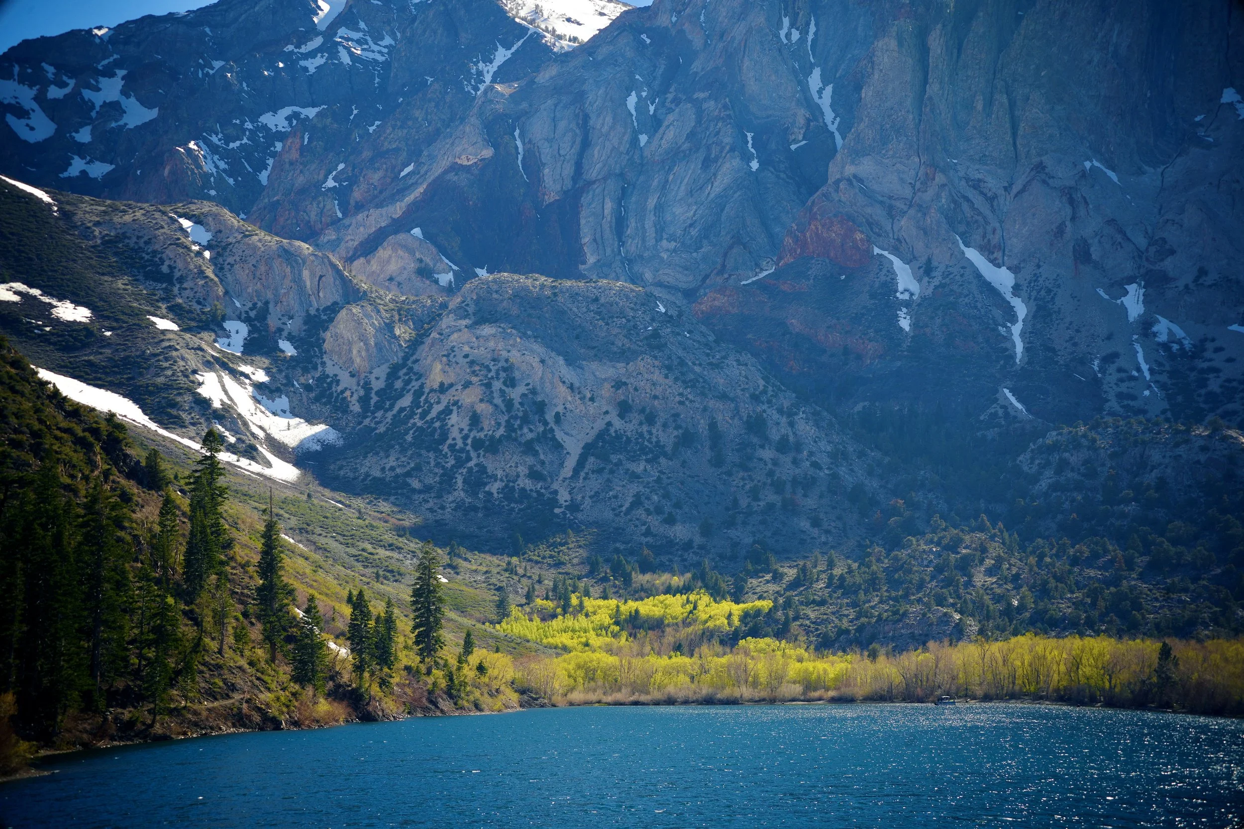
Convict Lake in early spring. The water is this color because of suspended glacial minerals. The aspens are this color because they just leafed out. Neither requires enhancement.
Convict Lake sits at 7,583 feet, carved by glaciers that retreated roughly 15,000 years ago and left behind a moraine at the canyon mouth that dams the water still. The geology visible in the surrounding hillsides is the oldest in the Sierra — metamorphic rock laid down 350 to 400 million years ago, compressed and folded and later invaded by the granodiorite intrusions that the glaciers then scattered as white boulders across the canyon walls. Standing at the water's edge, the rock faces on three sides are so close and so large that the lake feels less like an opening in the landscape and more like a room in it. The water is an implausible blue-green — colored by suspended glacial minerals — and so transparent that the lakebed is visible several meters out. The aspens around the canyon fringe have just leafed out in early spring, their yellow-green canopy catching the light at an angle that makes them glow against the grey granite.
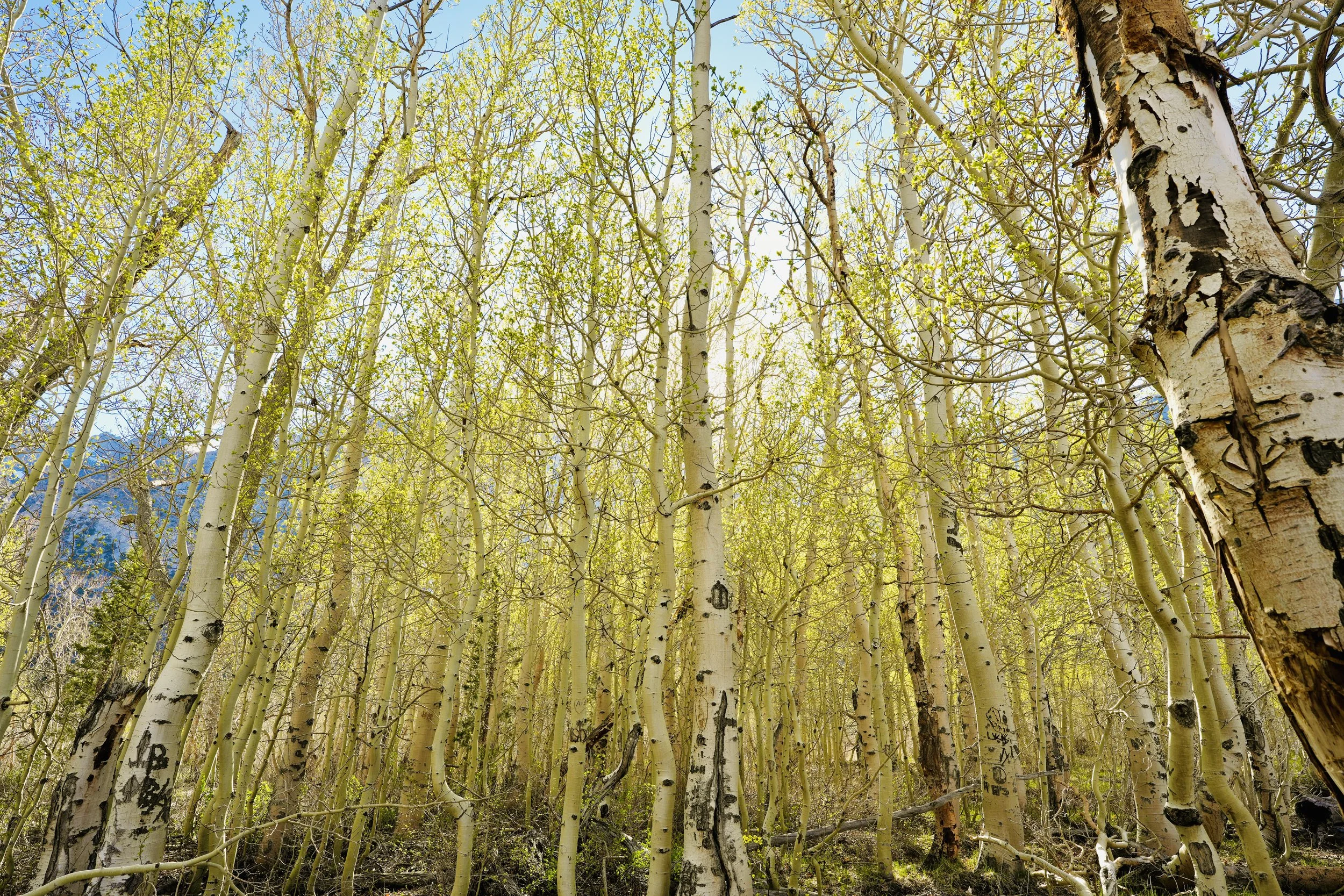
Aspens in early spring at the canyon edge. Aspen groves are clonal organisms — each tree genetically identical to its neighbors, connected by a shared root system. What looks like a forest is a single entity.
The aspens deserve a longer look than they usually get. In autumn they draw the crowds, their leaves turning gold against the granite. But in spring, coming into leaf before anything else at this elevation has managed it, they are something stranger and more interesting — a luminous yellow-green that seems lit from within, the white trunks pale as birch against the dark rock. What most people don't know is that an aspen grove is not a collection of individual trees. It is a single organism — a clonal colony sharing one root system, each trunk genetically identical to every other. What looks like a stand of trees is more accurately described as one tree with many trunks. Some aspen colonies are among the largest and oldest living organisms on earth. The grove at Convict Lake, pushing new growth up through the still-cold air of early May, is doing what it has done for thousands of consecutive springs.
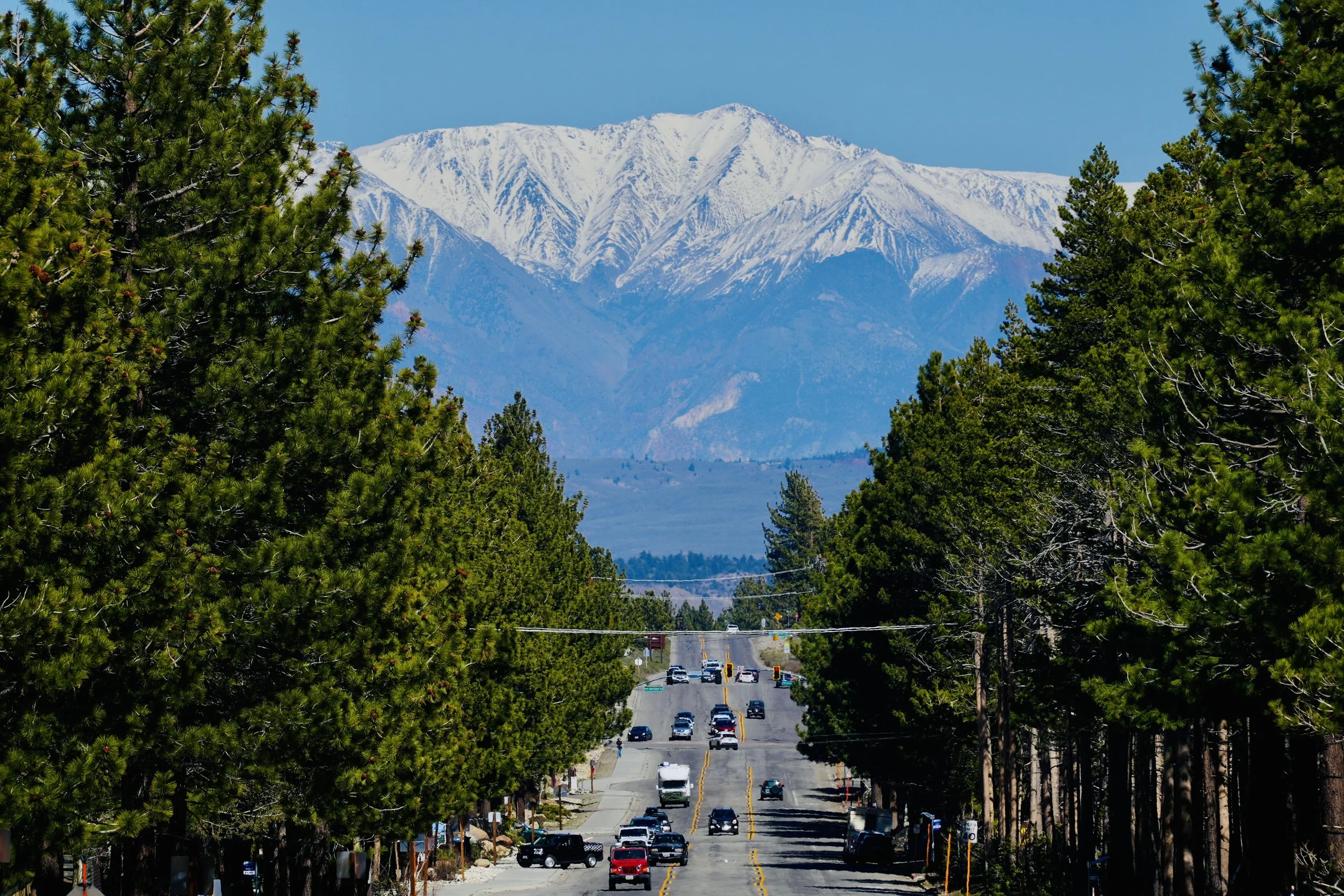
Main Street, Mammoth Lakes. The road runs straight into the mountain and the mountain fills the frame completely. There is no angle from which the town escapes its own geology.
The town of Mammoth Lakes, seen from the main road as the pines open up on either side and the mountains press close above, is a resort town that has learned, mostly, not to overwhelm its own setting. The two-lane road runs straight toward a snow-covered peak so large it fills the windshield completely — a framing so apparently designed for effect that it is difficult to believe it is simply geography. The permanent population is around 8,000 people. In winter it absorbs several times that number. The economy is organized around snow — around the 400 annual inches that fall on the mountain and the 3,500 skiable acres they cover and the visitors who drive seven hours from Los Angeles to stand on top of it.
The tension that runs beneath the resort economy — between the town that services visitors and the mountain that generates them, between the water that falls here and the city that claims it, between the geological violence underneath and the recreational calm on top — is the most interesting thing about Mammoth Lakes. It is a place built on a supervolcano, in a valley whose water was taken, at an elevation where winter lasts eight months and the summer is over before it has time to exhaust itself.
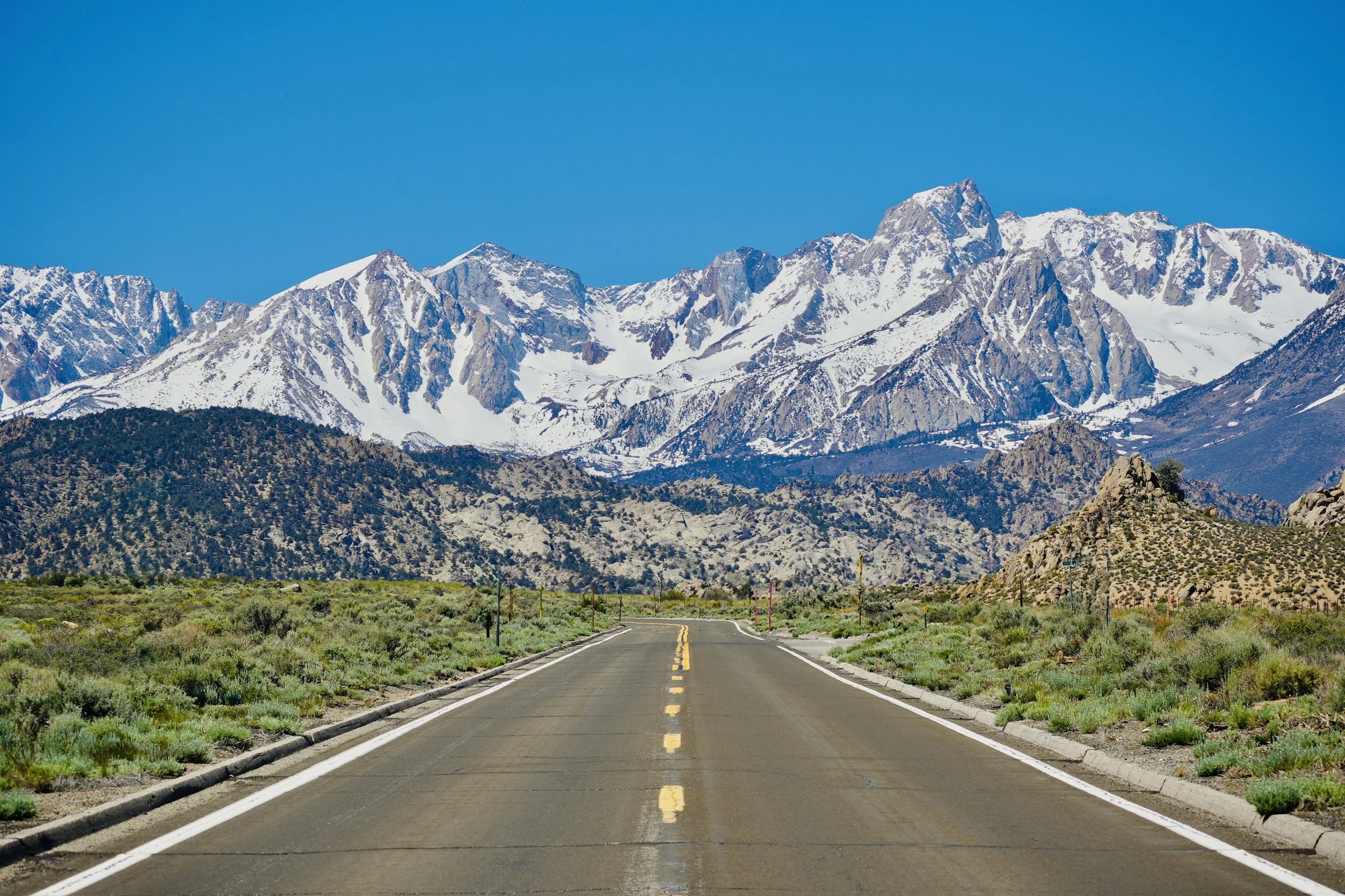
US-395 or Main Street — the road that leads to everything here, with the mountain at the end of it. On an empty stretch, the scale of what lies ahead becomes clear.
The empty road is the right image to end on. In the Eastern Sierra, the road is not incidental — it is the organizing logic of the entire landscape. US-395 is the spine of this place, the narrow corridor between the mountains and the desert through which everything moves: the water, the tourists, the freight, the history. Stand on it when no cars are coming in either direction, the asphalt running straight toward a wall of white, and you understand something about what it means to live at the base of something this large. The mountain is not backdrop. It is the condition of everything else.
Mammoth Lakes doesn't try to conceal what it is. The geology is visible. The water story is legible. The landscape imposes itself on every view from every angle. It is a place where the numbers are staggering — 760,000 years, 400 inches of snow, 233 miles of aqueduct, 350 million years of exposed rock — and where those numbers feel, for once, exactly as large as they should.
To see more photos & videos from my travels visit the links below
happy traveling,
~Sean
