Nikko: Where Time Becomes Measurable
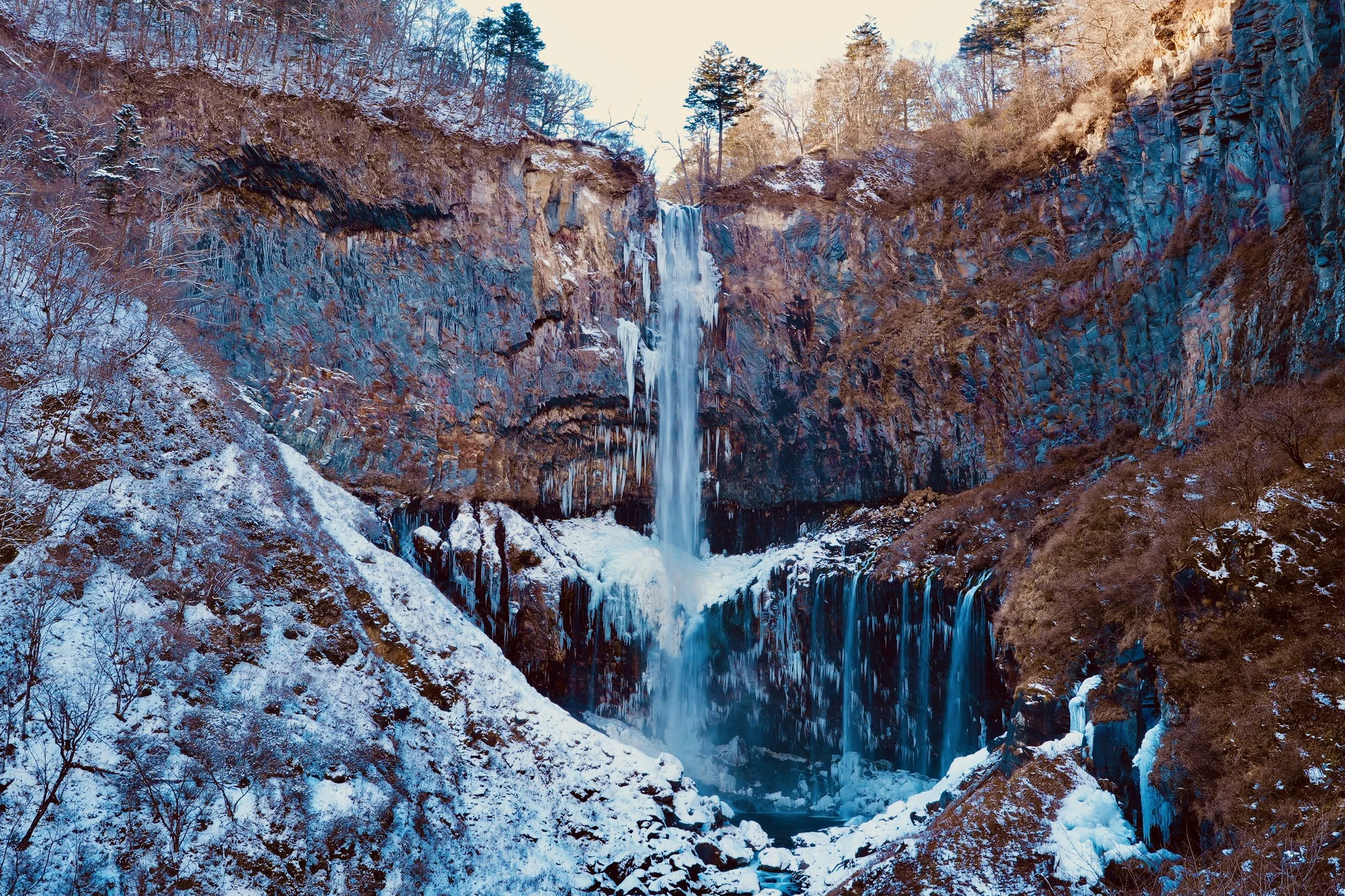
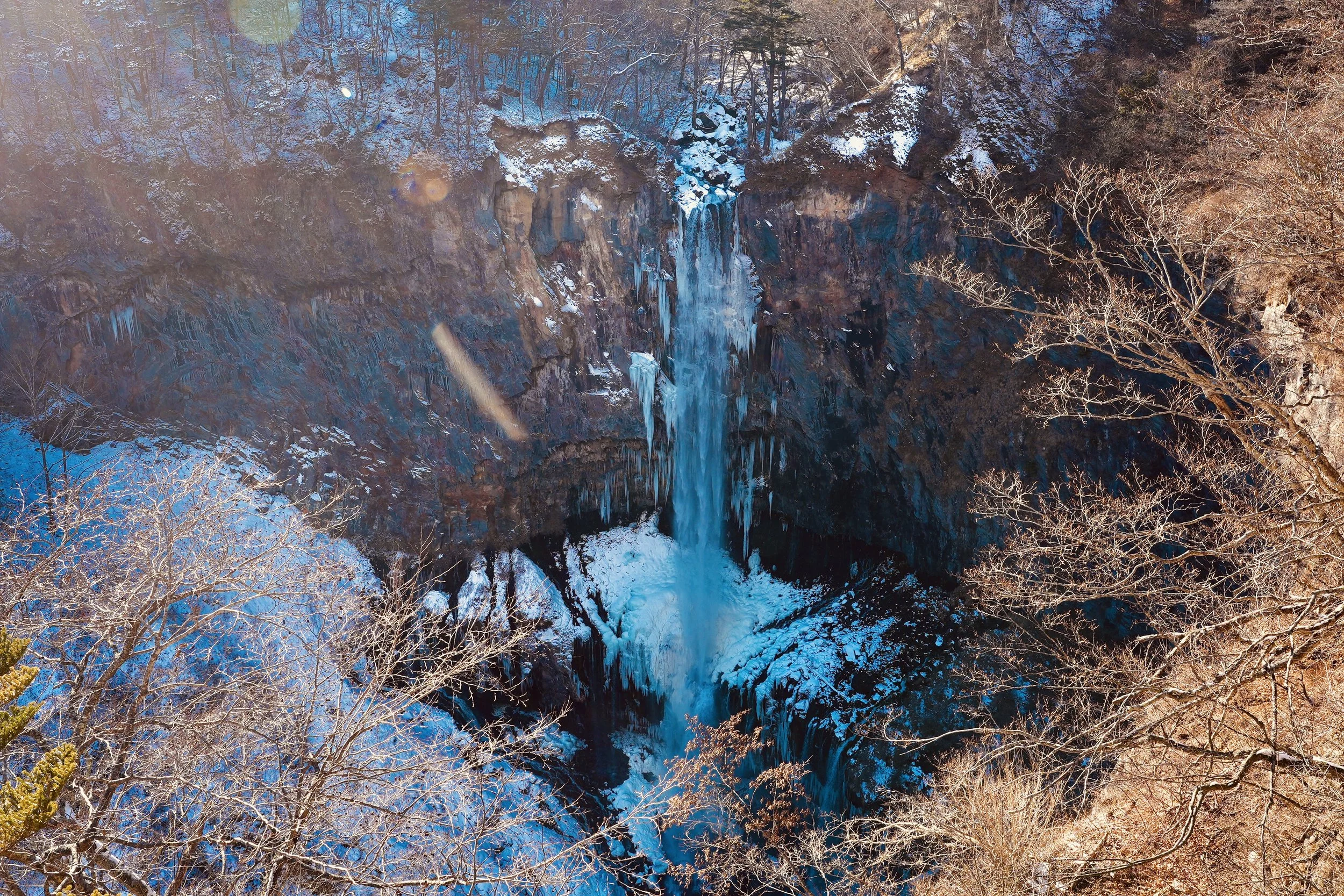
Kegon Falls — 97 meters of vertical drop, partially frozen but never fully stopped
Data scientists look for patterns. Nikko is one.
Located roughly 140 kilometers north of Tokyo, about two hours by rail, Nikko rises in elevation from the dense urban basin into mountain forest. It receives approximately 2.5 million visitors each year and has held UNESCO World Heritage designation since 1999. Those are the measurable facts. But none of those metrics fully capture what happens when you step into the cedar corridor and the signal bars fade. In Nikko, time stretches beyond quarterly cycles and tourist counts. It becomes visible.
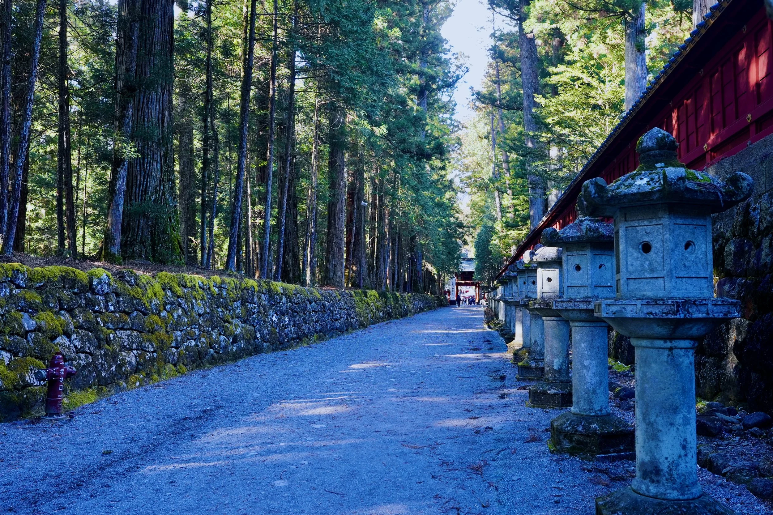
Cedar avenues planted over 400 years ago — infrastructure designed for centuries, not quarters
The cedar trees lining Nikko’s sacred pathways were planted in the early 17th century. For over four hundred years they have grown vertically, roots expanding silently beneath soil that has endured typhoons, snowfall, and seasonal extremes. In Tokyo, the average commercial building lifespan is often measured in decades. In Nikko, the planning horizon was centuries. These trees are not decoration; they are long-term infrastructure. Their continued presence is proof of a system optimized for durability rather than speed. Longevity here is not accidental — it is intentional design.
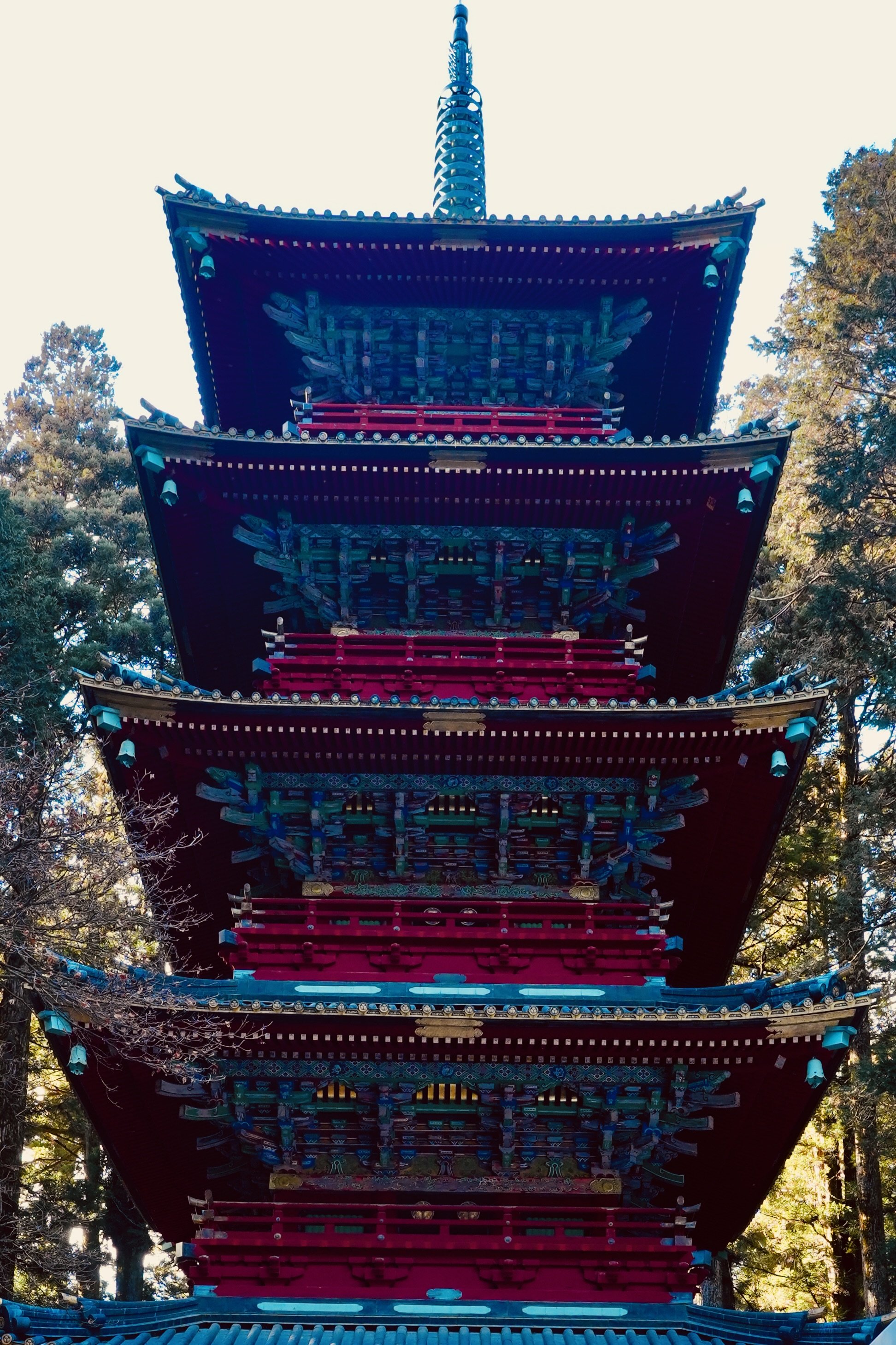
A five-story pagoda engineered with a central pillar system to absorb earthquakes
The five-story pagoda embodies structural intelligence. Japan experiences roughly 1,500 noticeable earthquakes each year, and traditional pagodas evolved in response to that volatility. The central pillar system, known as the shinbashira, acts as a shock absorber, allowing the structure to sway and redistribute seismic energy rather than resist it rigidly. The red and gold ornamentation draws attention, but beneath that visual complexity is engineering logic refined over centuries. Form and function are not separate variables here; they operate within the same equation.
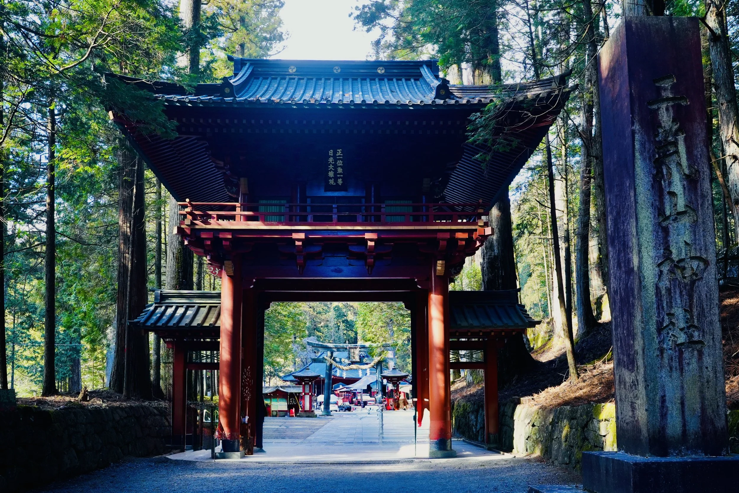
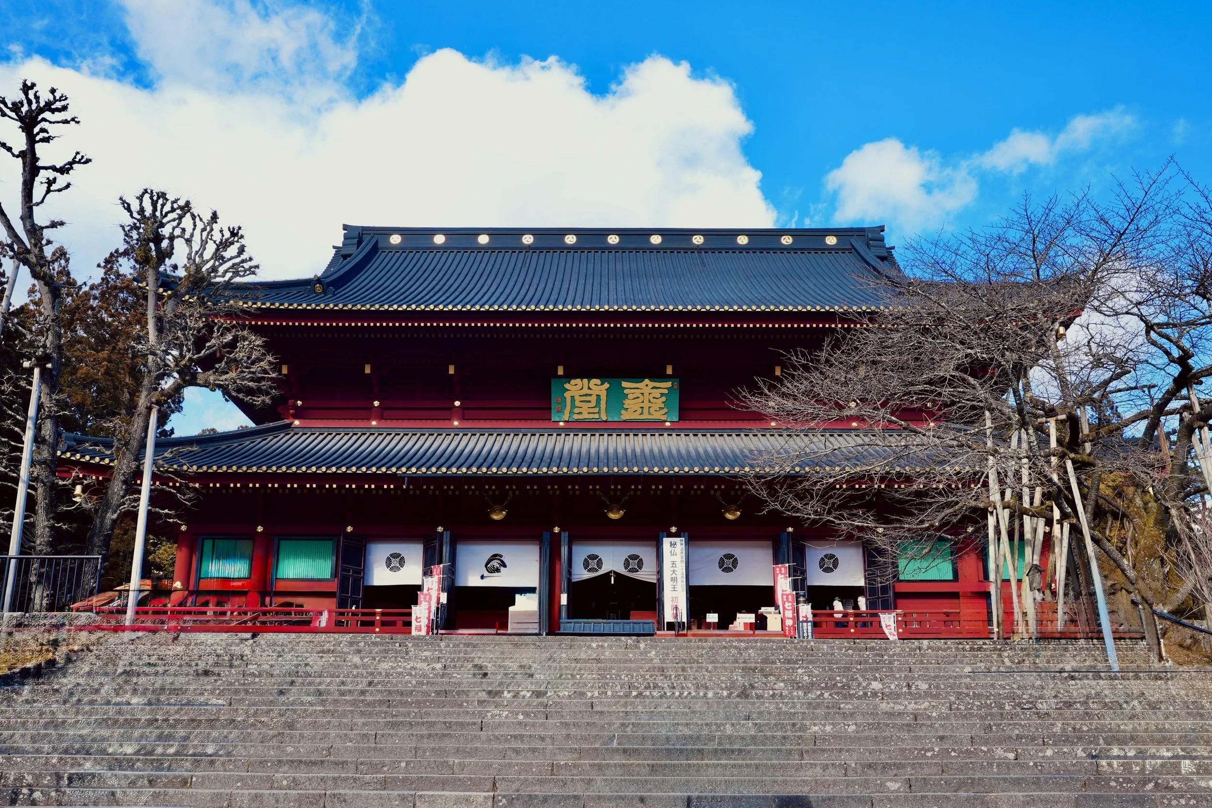
Layers of gates leading inward — physical design reflecting political centralization
Nikko’s Toshogu Shrine enshrines Tokugawa Ieyasu, founder of the Tokugawa shogunate, which governed Japan for more than 250 years from 1603 to 1868. That duration alone represents extraordinary political stability. The shrine complex includes more than a dozen major structures, adorned with thousands of carvings. Such scale signals long-term intent. Architecture becomes metadata — a record of centralized authority and continuity. Each gate you pass through narrows focus and deepens alignment, reinforcing not only spiritual progression but also historical permanence.
Temple scale measured in symmetry, repetition, and elevation
Symmetry dominates the temple complexes. Courtyards nest within gates, axes align along pathways, and elevation shifts mark transitions from the ordinary to the sacred. Movement upward is both physical and symbolic. If Tokyo optimizes for efficiency per square meter, Nikko optimizes for reverence per step. The design is not rushed. It slows you down deliberately, encouraging attention and recalibration. The geometry shapes behavior as much as the architecture shapes space.
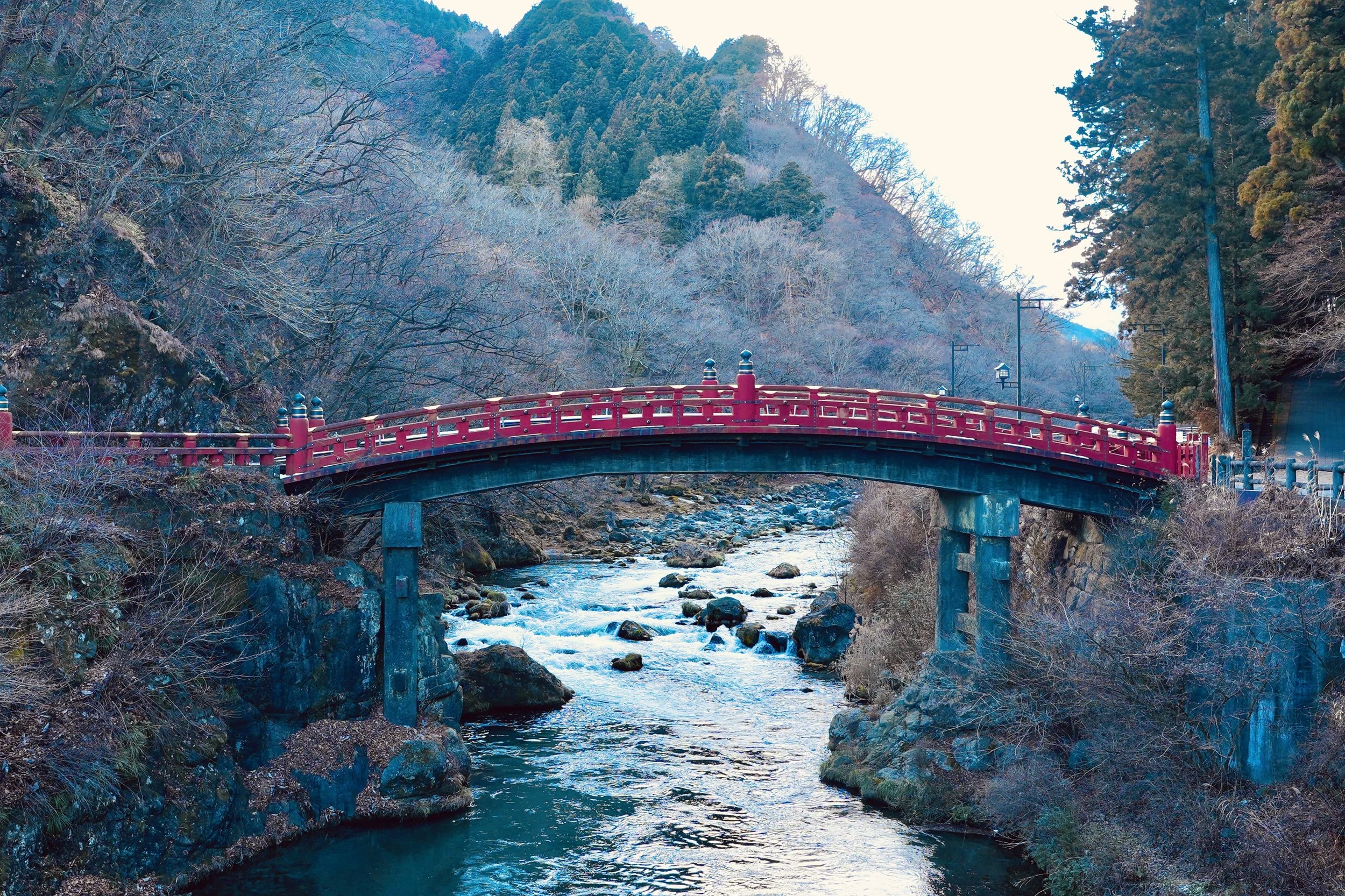
Shinkyo Bridge — vermilion arc crossing the Daiya River’s steady flow
The vermilion arc of Shinkyo Bridge marks the traditional threshold into sacred Nikko. Beneath it flows the Daiya River, fed by mountain runoff. Mountain rivers do not meander gently; they carve, erode, and reshape terrain with steady persistence.
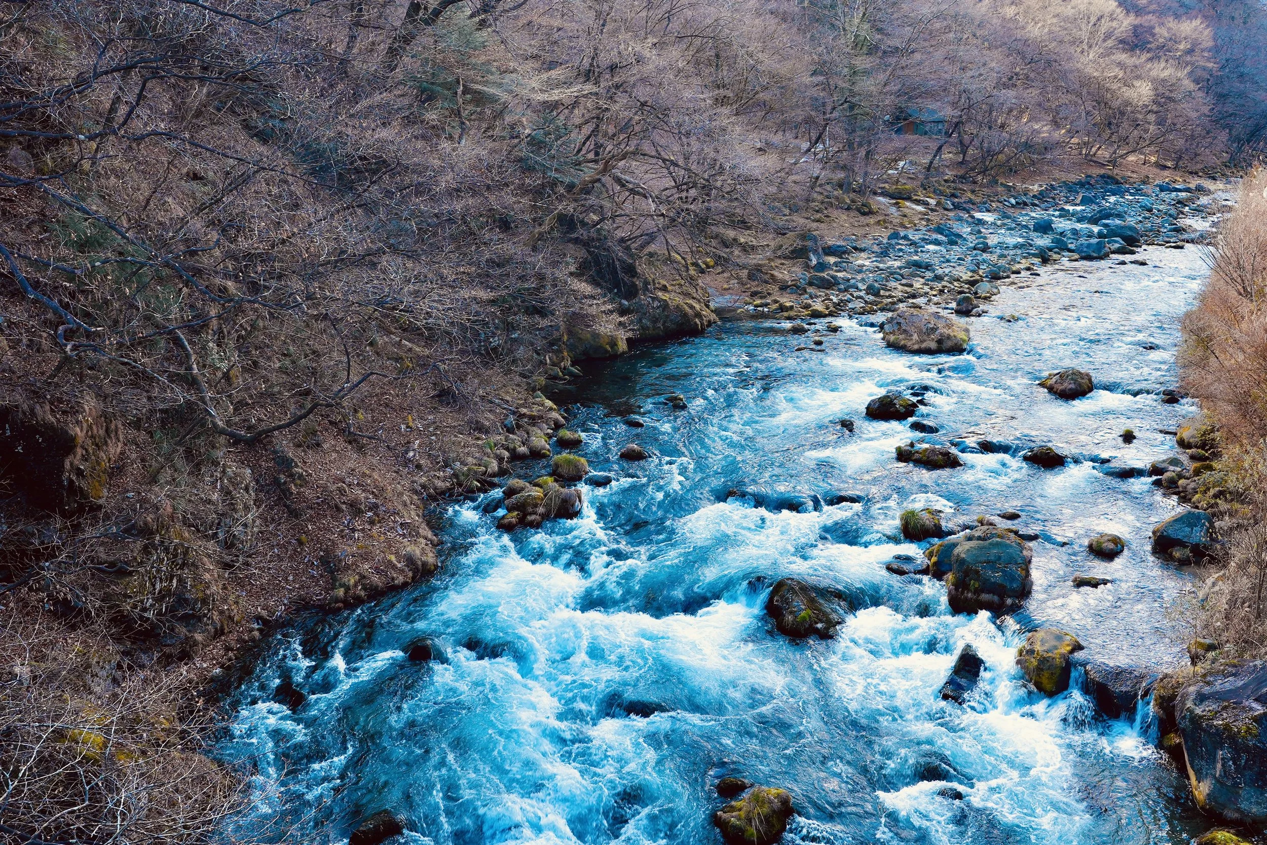
Mountain current — continuous energy transfer through rock and time
Flow rate is physics. Erosion is time quantified. Water becomes an algorithm that runs continuously, adjusting to terrain without ever fully stopping. In a world obsessed with acceleration, the river demonstrates a different model: constant motion shaped by constraint.
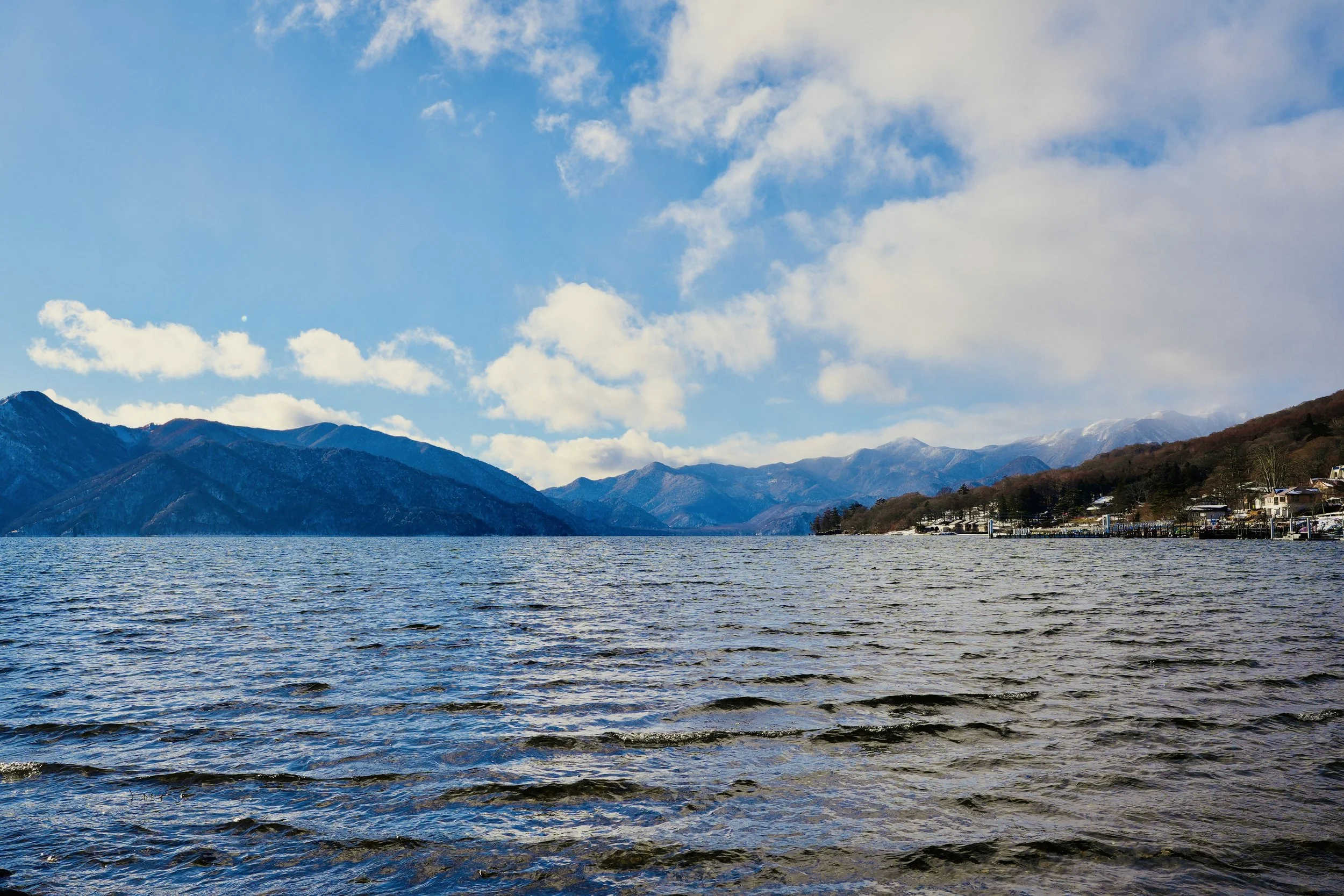
Lake Chuzenji — elevation roughly 1,200 meters, winter light refracted across restless water
Lake Chuzenji sits at approximately 1,200 meters above sea level. With elevation comes colder temperatures, altered wind behavior, and seasonal snow accumulation. Environmental variables shift measurably as you ascend. The lake’s surface refracts winter light differently than lower elevations would. Climate here becomes part of the architectural system — influencing how structures weather, how trees grow, and how water eventually descends toward its dramatic conclusion.
Winter transforms motion into structure — but never completely
Kegon Falls drops 97 meters. In winter, its outer edges freeze into vertical columns of ice, transforming motion into visible structure. Yet the central column continues to fall. Some variables freeze; others remain active. The system adapts without collapsing. The waterfall becomes a natural model of resilience under constraint — a balance between rigidity and continuity.
To see more photos & videos from my travels visit the links below
happy traveling,
~Sean