Ubon Ratchathani: Where the Land Runs Out
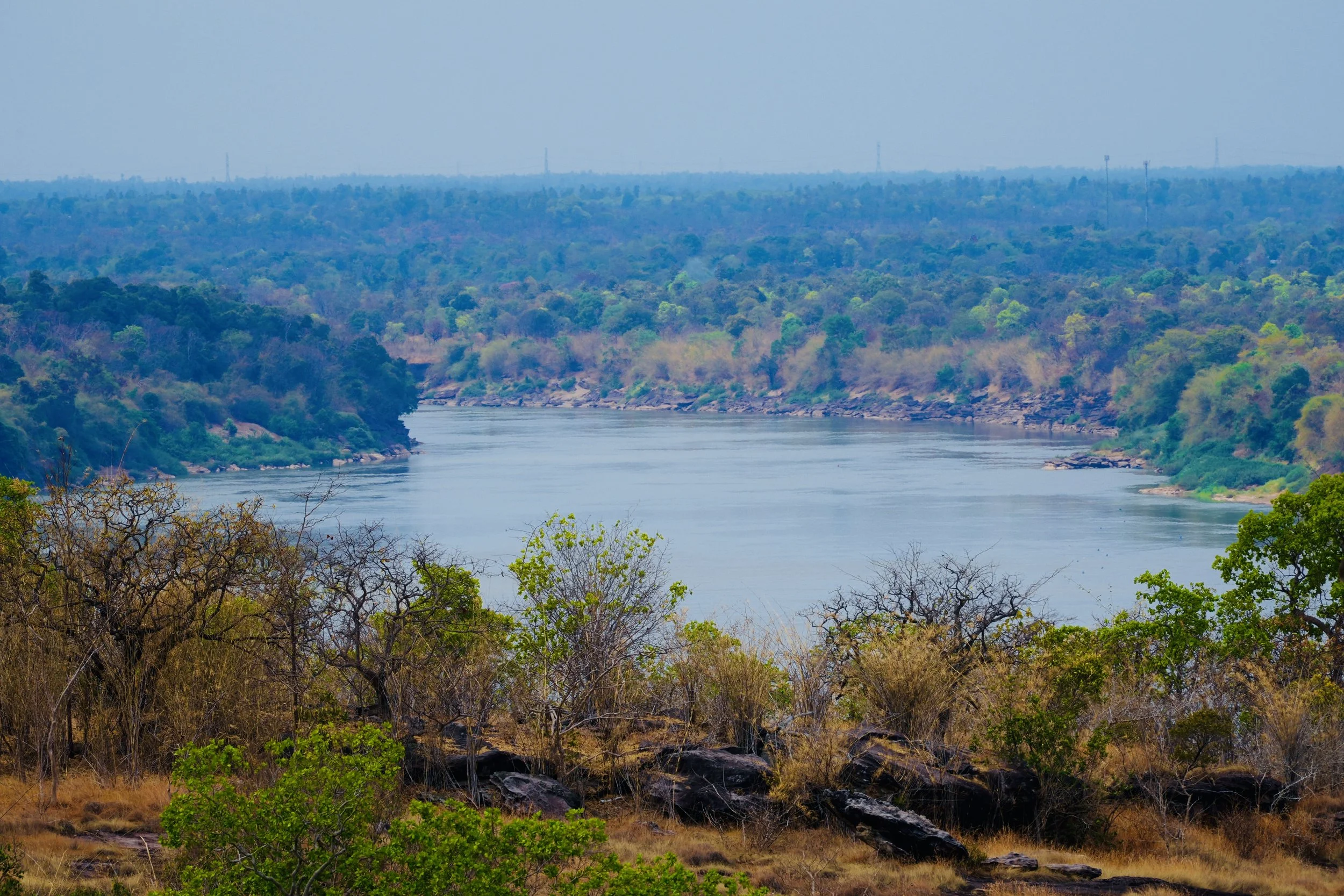
The Mekong River from the cliffs of Pha Taem, looking east into Laos. Thailand ends here. Everything beyond is somewhere else
The name says everything. Pha Taem translates, simply, as "painted cliff" — and for thousands of years before anyone thought to give this place a name in any language that survives, people stood on these same sandstone ledges above the Mekong and left marks on the rock. Not monuments. Not temples. Just marks — red ochre pressed into stone, figures of fish and humans and animals and hands, a record of daily life made permanent by the particular chemistry of pigment and geology and dry air.
You drive east from Ubon for roughly 95 kilometers, through rice fields that give way to dry dipterocarp forest, until the road ends at a plateau above the river. The landscape changes before you arrive. The flatness of the Khorat Plateau, which defines most of Isan, gives way here to something older and more dramatic — sandstone escarpments carved by the Mekong over millions of years, cliffs that drop sharply toward the river below. Pha Taem National Park covers 340 square kilometers of this terrain: plateau, cliff face, riverbank, and the forest that holds it together.
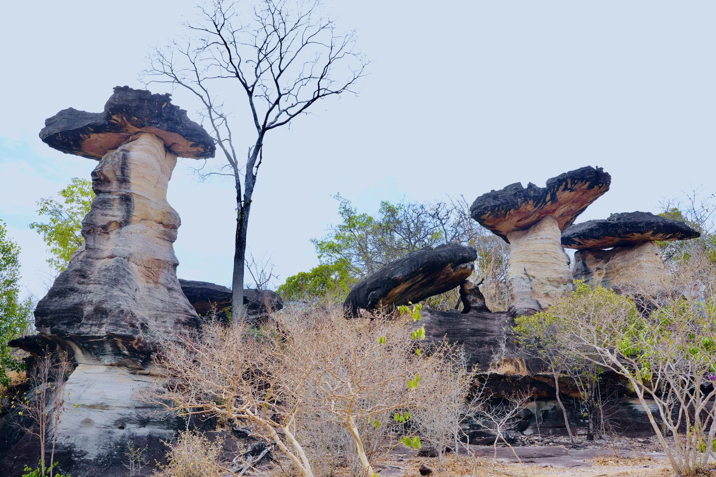
Sao Chaliang — the mushroom rocks of Pha Taem. Hard Cretaceous sandstone sits atop softer Jurassic layers, and erosion does the rest. Geology made visible
The mushroom rocks arrive before the river views. Sao Chaliang — named for their shape — are columns of sandstone that rise from the dry scrub, each one topped with a dark cap of harder Cretaceous rock that has resisted erosion while the softer Jurassic sandstone beneath it has worn away over millennia. The result is something that looks deliberate, almost architectural — as though someone stacked these formations by hand. They are the landscape announcing its own age. Standing among them in the dry season heat, the ground baked pale and the trees stripped to bare branches, the geological time on display is quietly vertiginous.
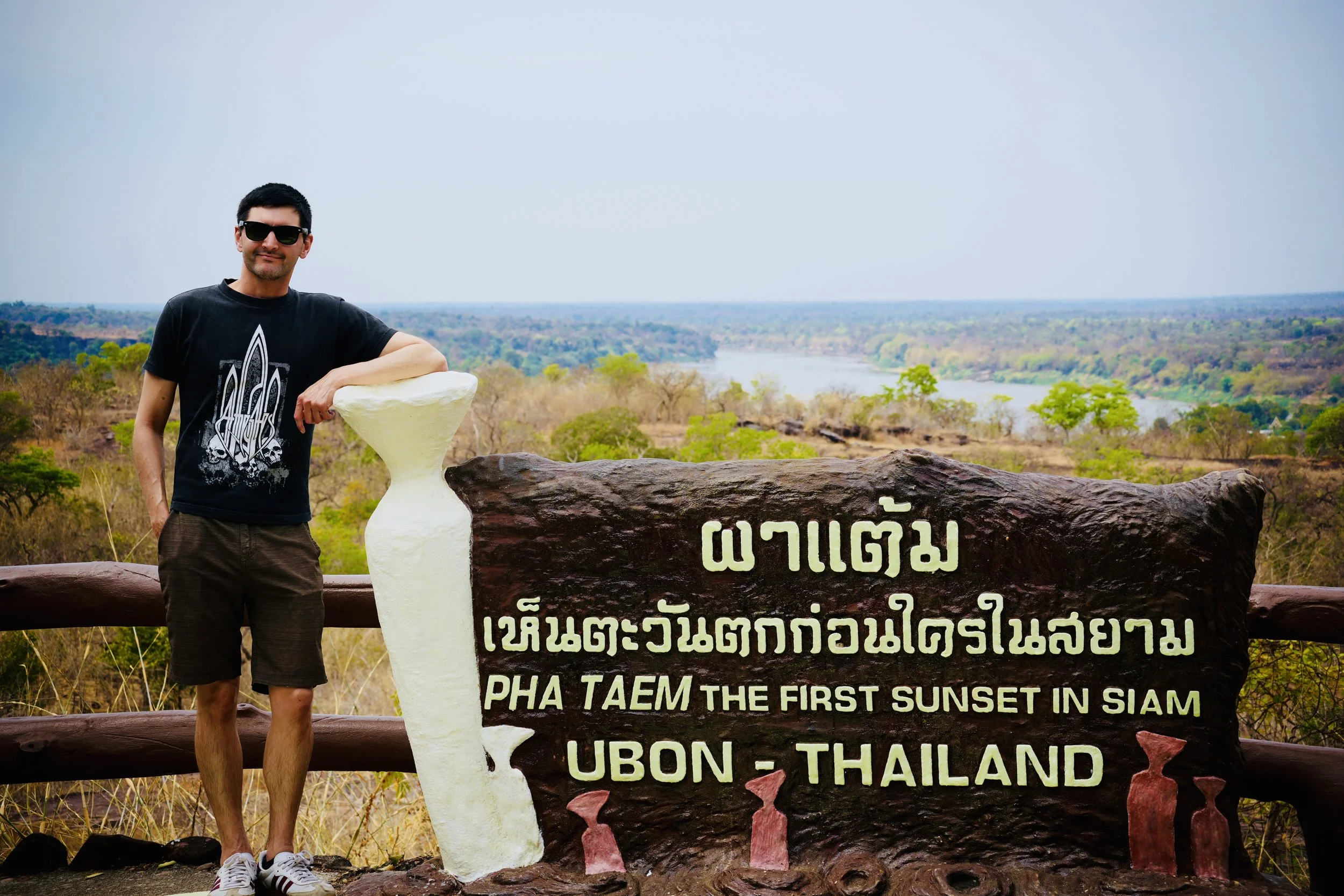
The sign at Pha Taem reads: "The First Sunset in Siam." Thailand's easternmost point, where the day begins before it does anywhere else in the country
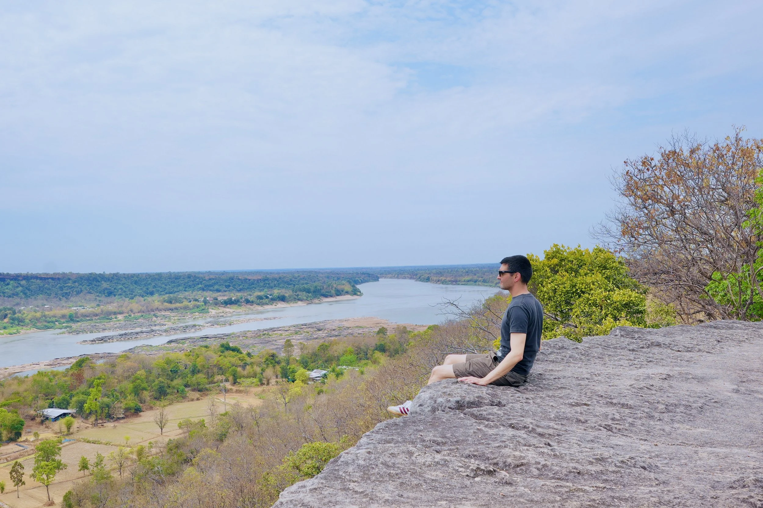
Pha Taem sits at one of Thailand's easternmost points — which means, on clear mornings, it receives the country's first light. The sign at the main viewpoint records this in both Thai and English with the kind of understated pride that belongs to places that have been significant for far longer than any sign has existed. What the sign doesn't record is the quality of the silence up here: the river wide and silver below, Laos green and hazy on the far bank, the air still and carrying the faint smell of dry grass and warm stone.
Looking east across the Mekong toward Laos from the cliff edge at Pha Taem. The river is the border, but it doesn't feel like one
From the cliff edge, the Mekong looks slower than it is. The far bank is Laos — the Phou Xieng Thong protected area sits directly opposite, its forest continuing without interruption from the Thai side as though the river were a detail rather than an international boundary. At this distance, the border is a bureaucratic fact. The landscape ignores it. The same dry dipterocarp forest, the same sandstone geology, the same river that has been flowing through this valley long before any of the countries it now separates existed.
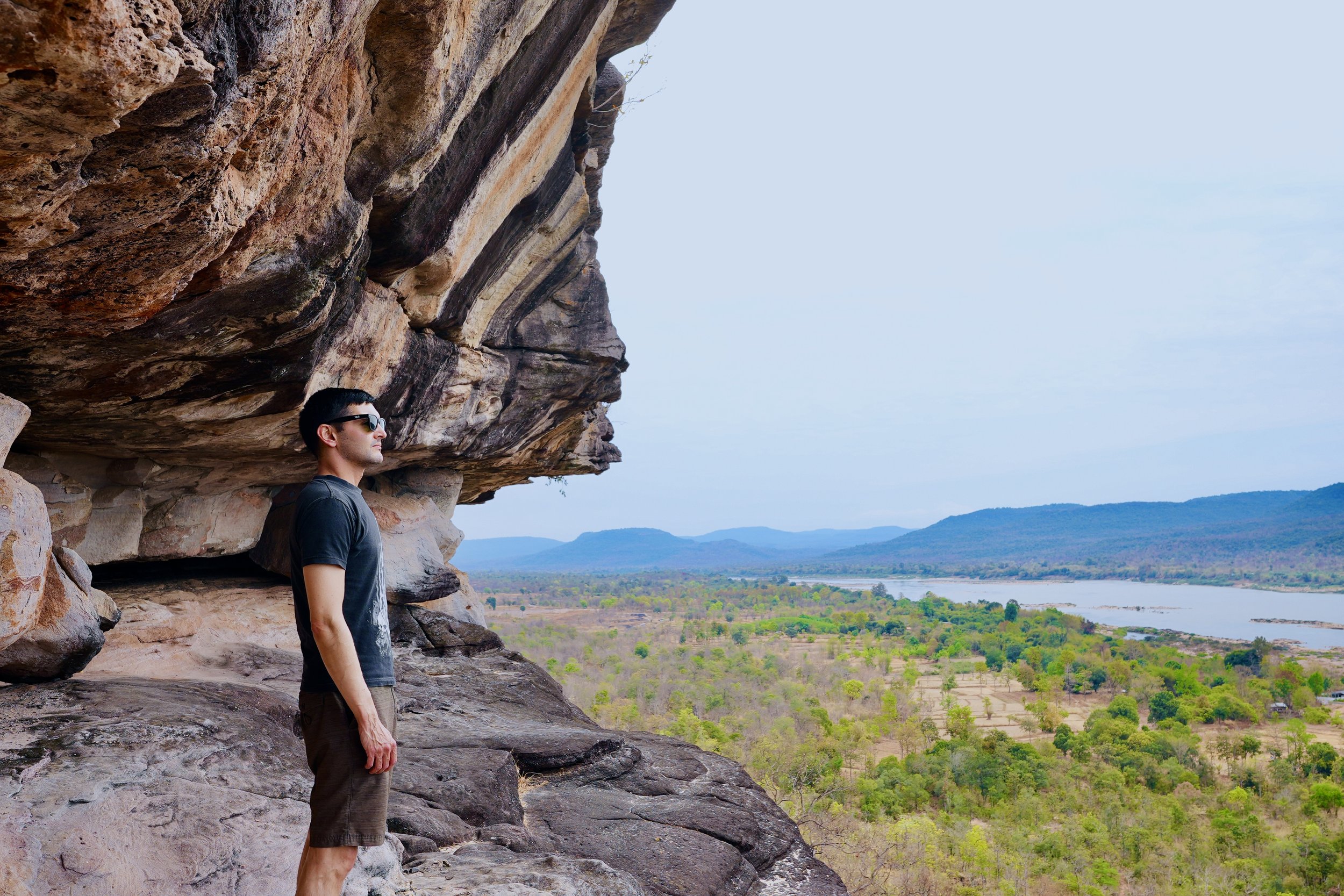
Under the sandstone overhang at Pha Taem. The rock above your head is the same rock the ancient painters worked on. The Mekong valley opens behind
The trail drops below the cliff line and runs along the base of the escarpment — a four-kilometer path cut into the sandstone, with the cliff face rising above and the valley falling away below. This is where the paintings are. More than 300 pictographs in red ochre stretch across 180 meters of cliff wall — the largest grouping of prehistoric rock paintings in Thailand and among the most significant in Southeast Asia. They were made between three and four thousand years ago by people who fished this river and farmed the land above it, and they are still here, pressed into the stone, faded but legible.
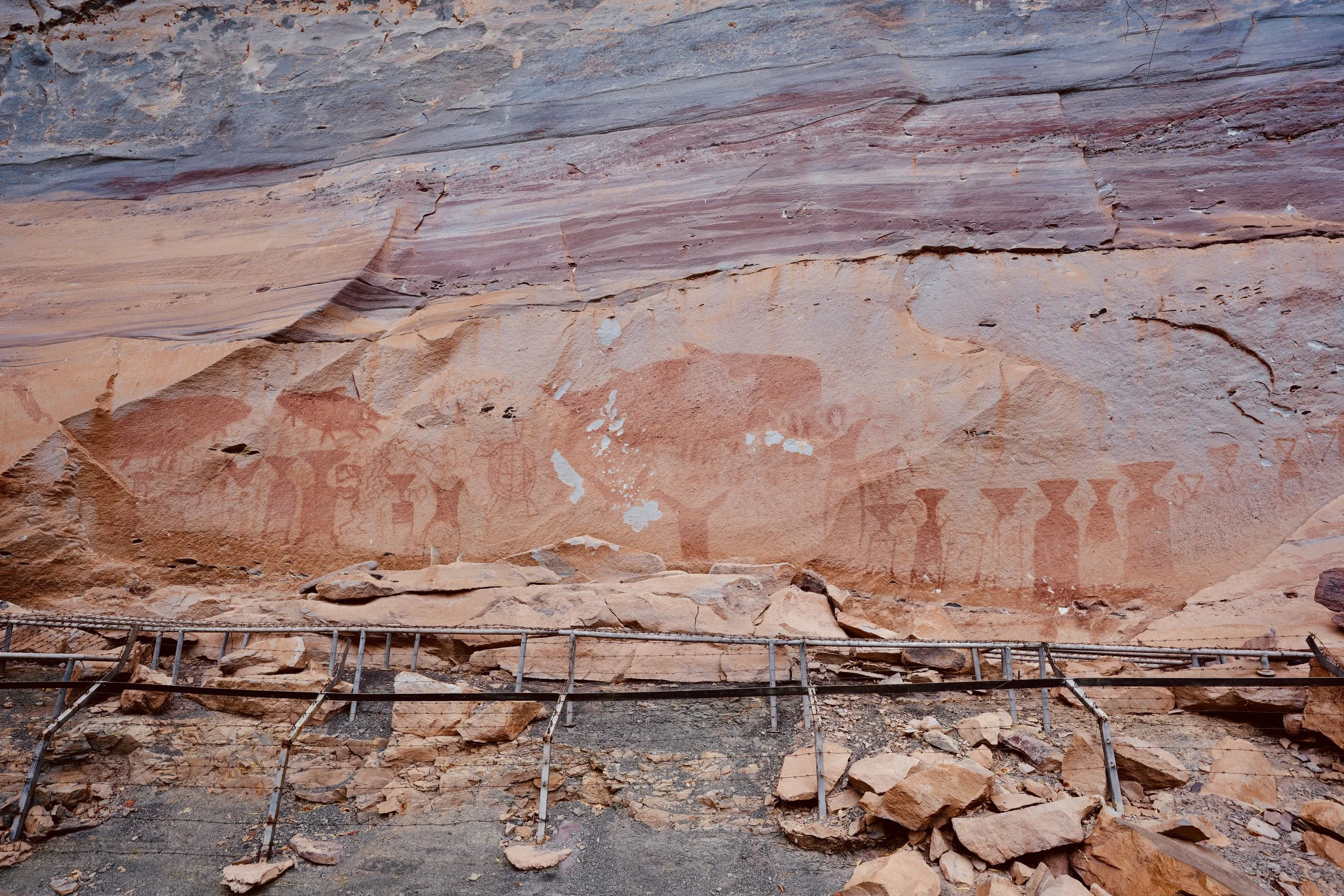
Prehistoric rock paintings at Pha Taem, painted in red ochre between 3,000 and 4,000 years ago. Fish, human figures, handprints. A record of life along the Mekong that predates every border on the map
The paintings are larger than you expect. Giant Mekong catfish — a species still sacred in local culture — dominate several panels, painted at a scale that matches their importance. Human figures, turtles, elephants, fishing traps, storage jars, handprints pressed flat against the stone. The scenes are not mysterious once you understand them. They are agricultural. Practical. People recording the things that mattered: the river, the catch, the harvest, the body. The red ochre has survived four millennia of monsoons and dry seasons and is still bright enough to read clearly against the sandstone.
What stays with you is not the age of the paintings but their specificity. These were not made for posterity. They were made by people who lived here, on this cliff, above this river, who fished with the same traps they painted on the stone. The Mekong below is the same river. The catfish are still there. The land, stripped back to dry scrub in the hot season, still looks something like what those painters would have known.
Numbers sketch the outline of Pha Taem — its 340 square kilometers, its 300 pictographs, its three to four thousand years of human record. But numbers don't capture the specific feeling of standing under that overhang in the afternoon heat, looking at a painted hand pressed into stone by someone who stood in exactly the same spot, and understanding that this place has always been significant. It didn't need to be discovered. It only needed to be reached.
To see more photos & videos from my travels visit the links below
happy traveling,
~Sean